Swimming Holes
|
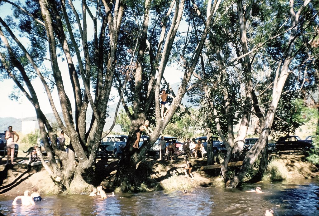
Mt Beauty Rock Pool
There was a huge rock outcrop about 6' above the water line and you could jump from there into a nice deep backwater natural pool. Later, a diving board was erected, being bolted to a concrete block (shown below).

(Click smaller photos to enlarge)
|
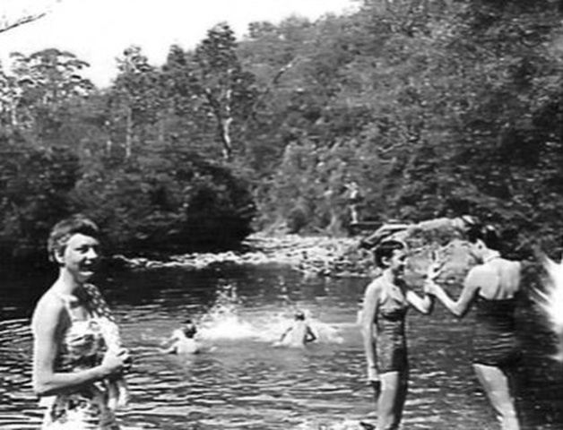
The diving board is seen in the background. Bill Hutton says it is him preparing for a dive. Bill has also recognised Marjorie Mills as the girl in the centre front, talking to Patty Hall and the school teacher to the left is Helen Young. This photo was taken in about 1960. For some years, around this time, the school swimming sports were held at this location.
|
Marbuck Pool
Many of the older boys would tire of the swimming crowd and journey upstream over rough rocks and bush from the Rock pool and swim in what was known as the Marbuck. Just recently, being curious about the origin of the name Marbuck, this is what I have researched.
Marbuck was the aboriginal boy in the first colour film produced in Australia in 1955, "Jedda". Marbuck takes his girlfriend Jedda, raised by a white family, away after his tribe denounce their untraditional union. They are hunted by an Afgan/Aboriginal stockman, who loves Jedda, so the couple go to the top of a gorge and throw themselves off as they think that they will be together in spirit.
|
I have a hunch that someone named our famous swimming hole "The Marbuck" owing to the likeness of the high cliffs and water below, in the film, "Jeddah".
The pictures do tell a story that suggests some truth in this theory. I wonder if anyone out there knows any better or indeed the person who named it.
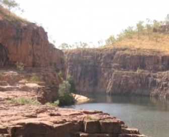
The actual gorge shot in the scene where Marbuck and Jedda fell to their death, in the film Jedda, released in 1955.
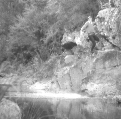
There is a great story about diving from the cliffs at the Marbuck hole. No one person could write it better than Bill Hutton. You can read Bill's story 'The Marbuck Dive' by clicking here or going back to the Mt Beauty Main Menu.
|
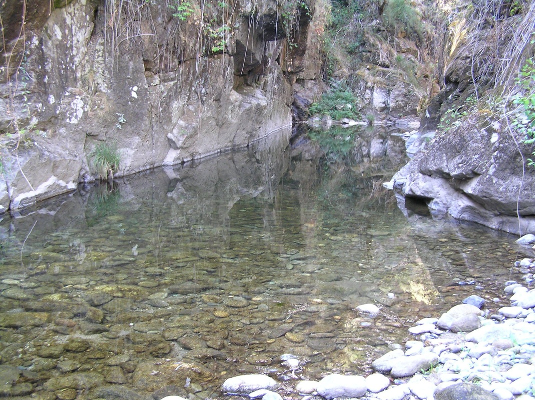
Above is a photo of the opening into the Marbuck hole with the huge rock faces of the gorge.
|
Spider's Cove
Another swimming hole on the East Kiewa river was known as Spiders Cove by local kids or Mulloga (deep pool) by aboriginals from time gone by. The local kids called it Spiders Cove due to the giant rock spiders inhabiting the rock faces. The spiders were about the size of an open hand. The swimming hole was situated about 700 metres upstream from the Marbuck, directly below Cranky Charlie. The pool was not frequented much due to the high cliffs and the deep pools. Old timers said it was bottomless and that aboriginal legend said it was inhabited by a mulloka (evil water spirit). Of course that scared the hell out of us kids. A beautiful long deep pool surrounded by high cliffs, but we used to swim the length of it with a great deal of trepidation.
|
Mermaid Pool
Another popular pool around the Kiewa Valley, was the Mermaid Pool, about 200 yards downstream from the Rock Pool. The Mermaid pool had a sandy bank and was great for the younger kids and their mums. It is still a very popular swimming hole today.
|
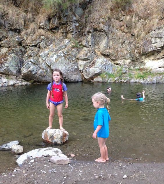
Above: Photo of Kim White, taken in 1963, at the Mermaid Pool. Fresh, clean, cool mountain stream water where families swam and still swim.
Left: Grand niece and grand nephew of Kim play at the Mermaid Pool in 2014.
Just a little history while mentioning the Mermaid Pool. Possibly 50 yards from the river was where some of the first dwellings for workers on the Kiewa Hydro Scheme were built. This was after the January, 1939 infamous bushfires, that ravaged the whole area. It was before roads, before construction of the scheme began, that some humble surveyors and carpenters built their own shacks to help pioneer the hydro works.
|
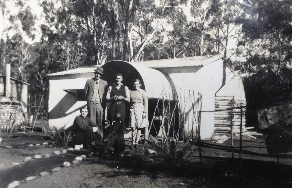
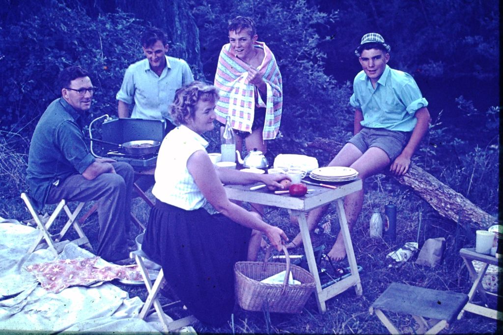
Joyce and Charlie Roberts and Gordon and Hazel White, pictured above, were two families that built their homes out of flour bags, corrugated iron, tree logs and dirt floor at this location just 50 yards from the Mermaid Pool. Charlie and Gordon were carpenters on the Kiewa Hydro Scheme. They lived here while they helped build the first SEC housing, Lower Bogong Village which was near the Clover Power Station, completed in 1940.
Diane Pool
The Diane Pool on the East Kiewa was situated basically between the mermaid pool and the scout pool. It was accessed via the rock pool road down a steep gradient via which you could drive your car to the rivers edge. You could also drive across the river at this point to access the rifle range and the target area. There was a flag pole and a sign warning of the rifle range. You could access Mountain Creek via this road but it was rough. It was very popular with Moms and Dads who had little children as it was relatively shallow and safe. A beautiful area. About 200 metres east of the pool was evidence of previous habitation with a brick stack about 2.5 metres high. Whilst we all thought it was remnants of a chimney, we were told it was the remnants of an old sewerage pit. Obviously, there were shacks or dwellings here at some point in time.
Scout Pool
Further downstream the East Kiewa River was a pool known as the Scout Pool. This pool was long and narrow and had blackberries all along the banks. We would sit in the cool water on a hot day and gorge ourselves, ending up with blackberry juice from head to toe.
Old Bridge Hole
The Old Bridge Swimming Hole was situated on Damms Road which about 1 kilometre at right angles to Valley Avenue and Nelse Street at North Beauty. The old bridge crossed the East Kiewa River at that point. The bridge was the old access to Damms Road taking you to Mountain Creek Road, which was the back way to Tawonga, Mountain Creek and the west end of the rifle range. The bridge was built in the very early 30’s and in the 50’s vehicles traversed it with care. The river at this point was magnificent with a shallow, long nearly 50m wide pool on the east side of the bridge with deep pools situated on the western side of the bridge. The deep pools extended for some 100 metres and from the bridge you could see clear to the bottom (4-5 metres). The sand lining the river was pure white and there was no moss on the rocks. The swimming hole was most popular in the 50’s both for swimming and fishing. However, over time the river changed, the deep pools disappeared and the old bridge was swept away by flood. Today, it is no resemblance of what it used to be.
Mud Pool (The King Of All Pools)
|
The Mud Pool was situated on the West Kiewa River adjacent to the main Mt Beauty SEC workshops on the Kiewa Valley Highway. It had high banks and we would have mud fights and slide down the muddy banks and into the water. Change sheds were built by the SEC and it became the most popular swimming spot in the area. The hole above the Mud Pool was long, rocky and relatively shallow and the river followed the bank in a tight right hand turn into the Mud Pool. The river banks were about 3 metres high with fast water and further downstream was a popular pool called the Willow Hole. Whilst most of the public used the main mud pool, the younger set utilized the quiet pretty little willow tree lined hole which had a diving board and was rock bottomed and clear.

|
Pictured above is the entrance to the Mud Pool.
In 1962, the SEC arranged for a weir to be built just above the old Mud Pool. Huge RSJ pylons were driven vertically across the river and wooden boards placed horizontally to back the water up along a straight section of the river. Although only about 4' deep it was an excellent stretch of water for swimming and acted as the school's "Olympic" pool. As the water backed up to the new weir, the old mud pool, as can be seen in the photo with children playing on the mud banks, soon disappeared as the popular hole.
|
|
The weir is completed and ready for roping off to provide
sports swimming lanes for school competitions. Pictured is Bert Gerecke, one of the SEC builders with his son Grenville, Sue Mc Kendrick and his daughter Pauline. 
|
The tree-lined bank of the new pool where families cooled off and the kids swam, swung and dived into the fresh water of the West Kiewa river. The same stretch of water looking upstream, as it is today, is pictured left.
|
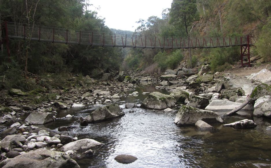
The Gorge
|
Recently, Bill Hutton and his wife, traveled back Mt Beauty and made the trek up to the Gorge. The following photographs were taken by them and show many of the scenes that Bill and Kim White saw most weekends 50 years ago.
The West Kiewa River Gorge commenced about a kilometre upstream from the mud pool. The commencement of the gorge proper began with the old log bridge constructed of massive logs indicative of the size of trees in the hills at that time. This was built in the late forties for cartage trucks during the construction of the West Kiewa Power Station and Adit Tunnel. The truck road is gone but a walking track exists in its place. |
|
The tail race tunnel up to the West Kiewa Power Station was constructed directly beneath the river and inspection tunnels (nearly filled in) are still evident today, although the log bridge was washed away during the 2010 floods.
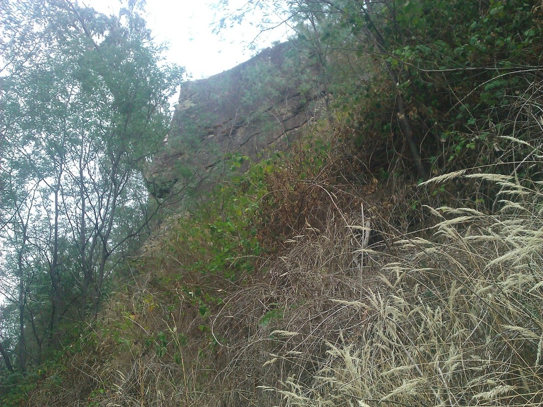
The Gorge had high cliffs on both sides, which we as kids, used to climb and inspect the many caves hidden within. One of the high cliffs we called the Indian Rock (pictured right) as the rock face looked like the side on view of an American Indian. The top of the rock stood about 100 metres above the river and access road.
The mighty Gorge Pool with sheer sides and impassable
at river level without getting wet. There were many swimming holes in the river all the way to the Gorge and power station, most of them very similar to the Mermaid pool in the East Kiewa River. The following is a slide show of the photos taken by Bill Hutton as he walked up along the Gorge track recently.
|
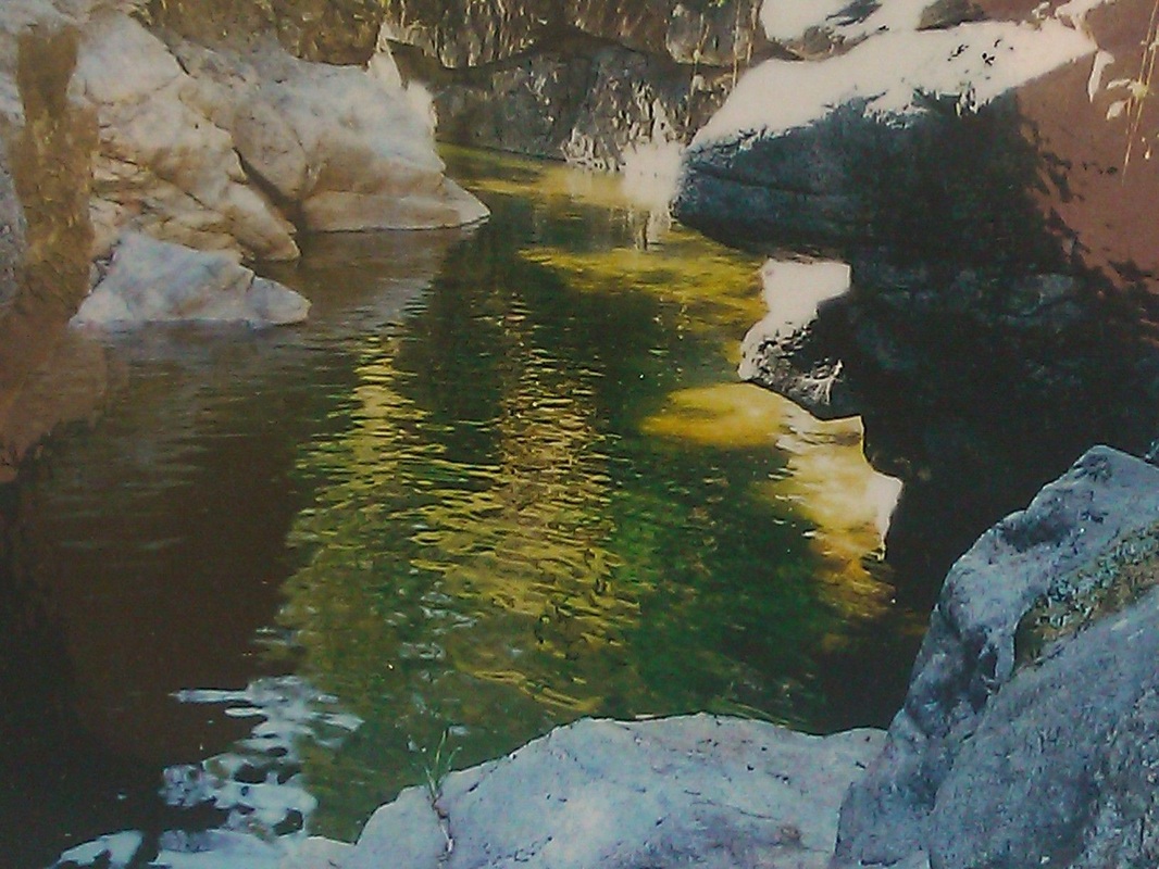
Canyon Pool
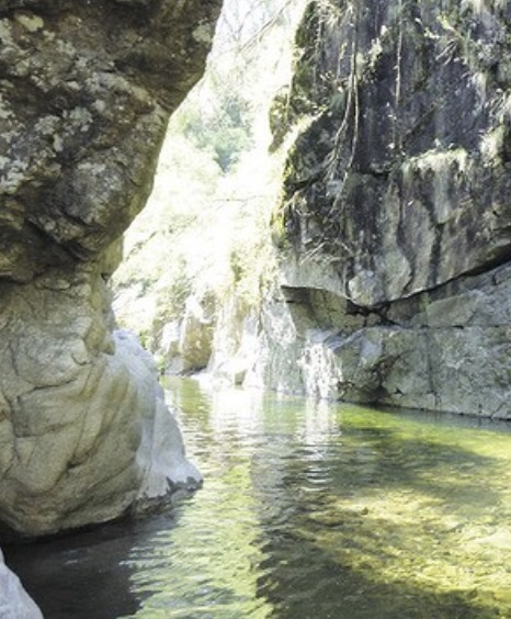
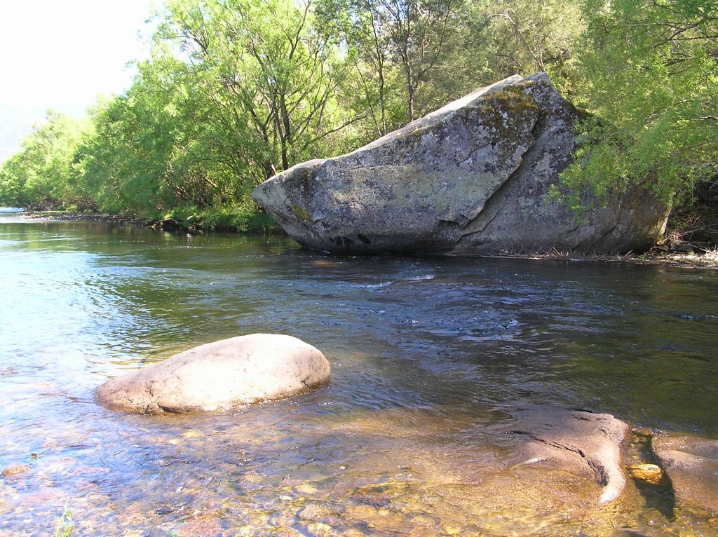
A spectacular pool known as the Canyon Pool was a long pool with crystal clear water surrounded by high cliffs. It still exists and appears as it did all those years ago. Unlike the East Kiewa river above the junction, the rocks surrounding the pools are clean and sparkling with the bottom of deep pools visible due to the clear water. A beautiful water way. This was often the dead end for most people as the cliffs were treacherous to climb over or you had to swim through the gorge holding your clothes above your head.
|
The Kiewa River Proper
CRB Lane
|
After the east and west Kiewa rivers meet at the "junction", about 3 kilometres from Mount Beauty downstream, the mighty Kiewa river widens and becomes deeper. Therefore, many of the frequented swimming holes from here downstream were popular but needed transport to get there. It was usually a family outing on the weekend to fish, swim and have a riverside bbq. This particular day was at a stretch of river that was called the CRB Lane.
The lane ran from the Kiewa Valley Highway at Coopers and Doubledays dairy farms through to the river. The lane was nicknamed 'CRB' as the Country Roads Board stored their screenings, plant and equipment there for the development of the bitumen road. It was also used for access to water for the project. |
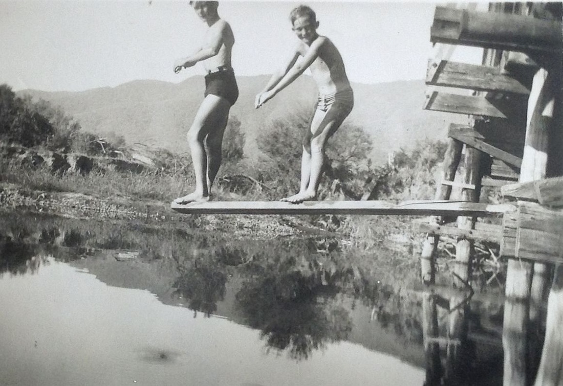
Tawonga Rock Pool
|
The Tawonga Rock pool, funnily enough named, had a huge single rock that could be see a kilometre away from the Kiewa Valley Hwy. This was a good deep hole and you had to swim across the river to get to the rock, climb it and dive in. There was a public road through the Cooper's paddocks and it was a favourite camping spot for visitors during summer and Easter holidays.
We would hitch-hike about 8 miles from Mt Beauty to get to this great hole and swim all day. 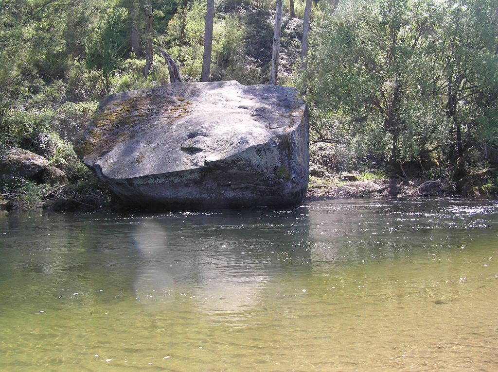
|
|
Redbank Hole
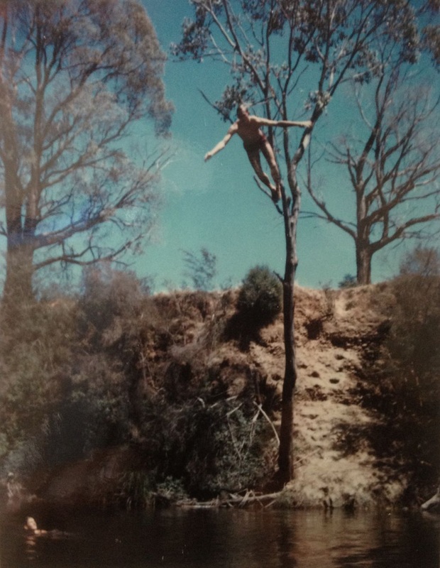
Above: Kim White soars 10m above the water after launching from the rear bank and letting go of the rope.
|
1Redbank, as it's name suggests, had a 20m high red soil bank and we erected a giant rope swing from one of the gum trees. The swing had different levels where you could hold the rope. The top level was the hairiest. It could take you 20 metres up into the air, let go and swallow dive into the River. The depth was about 2m so you had to make sure your dive was shallow or you would scrape half your chest off. Bill Hutton had no hair on his chest every summer.
The Red Bank Hole was always popular with the youth during the hot summer days and in the evenings with a fire by the river and a few cooling drinks. Pictured below are Barry Doyle, Judy Doyle, Kim White and Peter Handley in the shallows of the Red Bank pool. 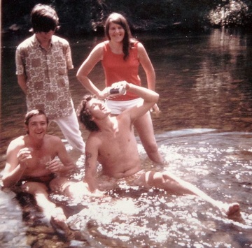
|
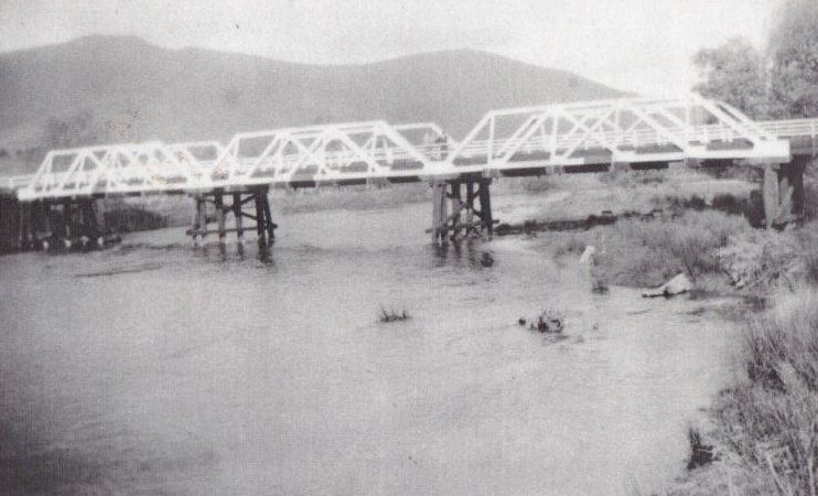
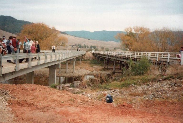
Keegan's Bridge

This unique photo of Keegan's Bridge was taken after floods took out the centre wooden pylons and collapsed the bridge. It appears to be around 1940. The bridge has been re-built three times after either early flood damage or age.
|
This was a popular swimming and fishing stretch of water and the bridge made good shade underneath on a hot day for a bbq and great fun diving from the bridge pylons.
|